A reflection on the success of the Public Private Partnership model to fight Financial Crime in South Africa
(29 November 2021)
AfriGIS attending:
Hein Badenhorst – CEO
AfriGIS
Laurette Coetzee – Business Development | Account Manager
AfriGIS
Esti Kilian – Chief Sales and Marketing Officer
AfriGIS
Event Topic:
The ACAMS South Africa Board would like to invite you to attend our next in-person event to discuss the success of the Public Private Partnership model to fight Financial Crime in South Africa.
The key note speaker for this event will be the Director of the Financial Intelligence Centre, Adv Xolisile Khanyile.
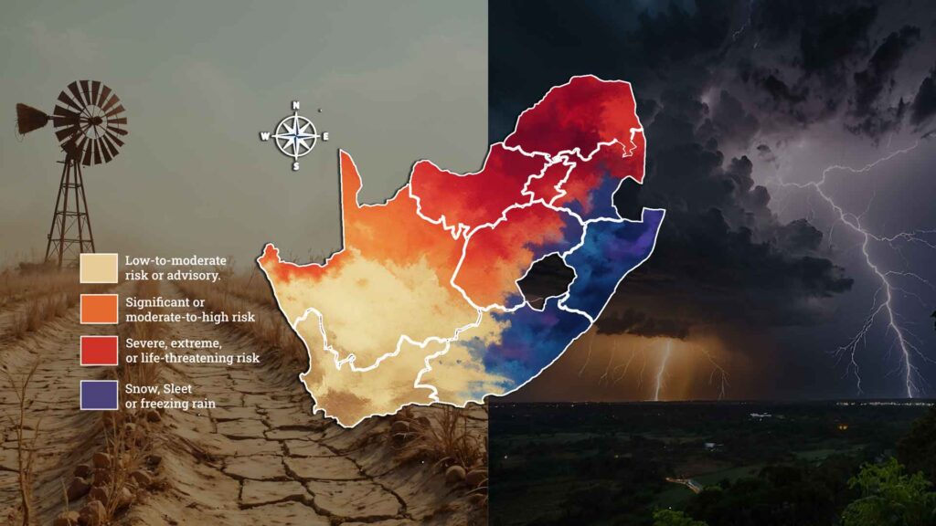
What rapid-response spatial intelligence knew before the Garden Route flooded again South Africa's Garden Route was hit by two cutoff low storms within a month, the second in early June 2026 bringing up to 200mm of rain across an already-satur…South Africa's Garden Route was hit by two cutoff low storms within a month, the second in early June 2026 bringing up to 200mm of rain across an already-saturated region with dams at full capacity, May's temporary road repairs still in place, and the N1 at Leeu Gamka eventually closing. Before that second storm peaked, AfriGIS had already used just four rapidly integrated spatial data layers roads, rivers, informal settlement locations, and storm warning data to identify 22 of the Garden Route's 209 informal settlements at extreme risk of losing all physical access, with Kannaland and George carrying 16 of those, enabling disaster management teams to pre-position resources and plan evacuation routes before conditions peaked. The deeper argument is that the same four-layer foundation becomes substantially more powerful with each additional dataset layered onto it: add deeds and cadastre data and an insurer can move to parcel-level flood underwriting; add CIPC business data and you can quantify revenue disruption, not just building damage; layer in infrastructure assets and Transnet, Sanral, and Eskom can each see where their balance-sheet exposure becomes critical. AfriGIS positions this building-block quality backed by 28 years of authoritative, never-crowdsourced verified data as the foundation for what national-scale spatial preparedness could deliver as SA's rainfall season runs through November.
What rapid-response spatial intelligence knew before the Garden Route flooded again South Africa's Garden Route was hit by two cutoff low storms within a month, the second in early June 2026 bringing up to 200mm of rain across an already-satur…South Africa's Garden Route was hit by two cutoff low storms within a month, the second in early June 2026 bringing up to 200mm of rain across an already-saturated region with dams at full capacity, May's temporary road repairs still in place, and the N1 at Leeu Gamka eventually closing. Before that second storm peaked, AfriGIS had already used just four rapidly integrated spatial data layers roads, rivers, informal settlement locations, and storm warning data to identify 22 of the Garden Route's 209 informal settlements at extreme risk of losing all physical access, with Kannaland and George carrying 16 of those, enabling disaster management teams to pre-position resources and plan evacuation routes before conditions peaked. The deeper argument is that the same four-layer foundation becomes substantially more powerful with each additional dataset layered onto it: add deeds and cadastre data and an insurer can move to parcel-level flood underwriting; add CIPC business data and you can quantify revenue disruption, not just building damage; layer in infrastructure assets and Transnet, Sanral, and Eskom can each see where their balance-sheet exposure becomes critical. AfriGIS positions this building-block quality backed by 28 years of authoritative, never-crowdsourced verified data as the foundation for what national-scale spatial preparedness could deliver as SA's rainfall season runs through November.