Addressing Geoscience Challenges in Africa.
(Pretoria, South Africa – 6 May 2024)

High Rate of Returned or Non-deliveries
The complexity of addressing systems and the prevalence of informal settlements in Africa can lead to a high number of returned or undelivered items. This challenge is compounded by the lack of standardised postal services and reliable address databases, emphasising the need for innovative geoscience solutions tailored to the African context.
Need for Detailed Store Location Insights
Businesses often face challenges in mapping and analysing their physical presence across diverse and sometimes poorly documented environments. A detailed view of store locations or service footprints is crucial for strategic planning, marketing, and logistics.
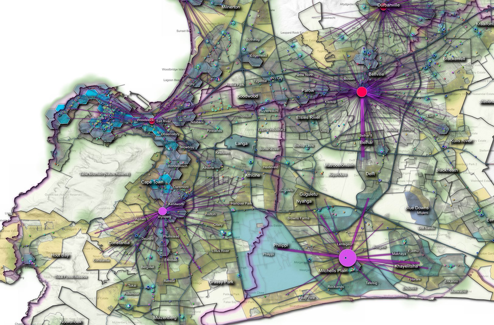
In-depth Understanding of Customer Demographics and Locations
The geographic diversity and socio-economic disparities in Africa make it challenging to gain insights into customer locations and behaviour patterns. Such understanding is vital for optimising service delivery and expanding the customer base.
Real-time Tracking of Assets, Sensors, and Personnel
The need for monitoring and managing the movement of assets, sensors, and people in real-time is critical, especially in areas with challenging terrains or limited infrastructure.
Access to Relevant and Reliable Data There is a pressing need for high-quality, accurate data that reflects the unique socio-economic and geographic characteristics of the region, impacting decision-making processes and the effectiveness of geoscience applications.
Unique Benefits of AfriGIS Offerings
Reliable Data Quality
AfriGIS ensures the reliability of its data by exclusively using authorised data sources, providing clients with trusted accuracy and integrity.
Accuracy Confidence Levels
We offer an accuracy indication, or confidence level, with our data, allowing customers to assess the reliability of the information provided for informed decision-making.
Africa-Specific Focus
Our services are specifically tailored to meet the unique needs and challenges of African Data, ensuring relevance and effectiveness for business in Africa.
Round-the-Clock Support and Data Security
We offer comprehensive 24/7 support services and prioritise the security of customer data, respecting its ownership and ensuring compliance with international standards.
Transparent Pricing and Integrated Spatial Datasets
Our pricing is transparent, and our services include linking all spatial datasets, enhancing data utility and accessibility for more comprehensive spatial analysis and decision-making.
Why Choose AfriGIS for Local Business Solutions?
With 27 years of experience, AfriGIS offers unparalleled insights into the African market, backed by a commitment to providing reliable, accurate data.
We prioritise the quality and reliability of our geospatial data by sourcing exclusively from authorised and verifiable sources, which allows us to provide our clients with trusted accuracy and integrity.
Each dataset comes with an accuracy indication or confidence level, empowering our clients to make well-informed decisions based on the reliability of the information provided. This commitment to high-quality data is underpinned by our focus on the specific needs and challenges of African Data, ensuring that our services are not only relevant but also highly effective for business in Africa. In addition, we provide 24/7 support to address any queries and ensure continuity in service, while rigorously maintaining data security protocols to protect the ownership and integrity of client data in compliance with international standards.
Further enhancing the value we offer, AfriGIS maintains transparent pricing without hidden fees, allowing businesses to plan their budgets effectively. We also integrate all spatial datasets, utilising a unique Spatial Entity OID (SEOID) to link varied data, thus enhancing the utility and accessibility for more comprehensive spatial analysis and strategic decision-making. This integration ensures that businesses can leverage our data for a wide range of applications, from market analysis and expansion strategies to optimising logistics and operational efficiencies, making AfriGIS a crucial partner in navigating the complex geospatial landscape of Africa.
Trends and Achievements in the Geoscience Field
Big Trends in Geoscience
From AI and IoT enhancing connectivity and data-driven insights to smart cities and disaster management, the geoscience field is rapidly evolving to meet modern challenges.
Notable Achievements of AfriGIS
Our recent expansions include international projects like NEOM, pioneering movement data projects, and enhancing data accessibility through improved APIs and advanced security measures.
IoT Solutions by AfriGIS
Precision in IoT Device Positioning and Advanced Geofencing Capabilities
Our technology ensures precise positioning of IoT devices and offers sophisticated geofencing solutions, enabling efficient routing and integration with live weather information for real-time decision-making.
Addressing IoT Challenges
AfriGIS leverages a broad ecosystem of partners and in-house capabilities to solve a wide array of customer problems, emphasising customer-centric co-creation of solutions to deliver substantial value and enhance efficiency.