Data

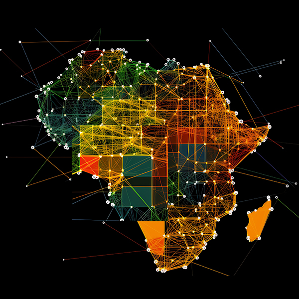
Addressing Geoscience Challenges in Africa

With 27 years of experience, AfriGIS offers unparalleled insights into the African market, backed by a commitment to providing reliable, accurate data.

Read More

How we hurdle the final obstacle to explosive online commerce in Africa

Couriers can help online retail in Africa overcome the final stumbling block to grow revenues and expand markets using quality verified and validated address data.

Read More

How African online retail will grow to the next level

Online retail in Africa represents an enormous growth opportunity but it will only be realised when online retailers and their courier partners can solve the “last mile” challenge of first-time delivery success. Here’s how they can do just that.

Read More

Geospatial data science is good for the books: here's why

Companies shouldn’t have to write off significant income to irrecoverable debt. This is how many are dealing with the crisis.

Read More

This is how you identify and fix poor quality address data

Six ways you know your address data are low quality, how to identify the problem, and what you can do about it.

Read More

How the brands we love use data now to actually be better

Maps apps and apps that use maps are so integral to our every day lives that we barely notice them anymore. But they make a big impact. Find out why the past was difficult, what the new challenges are, and how the brands you love use geospatial intelligence to make a difference.

Read More

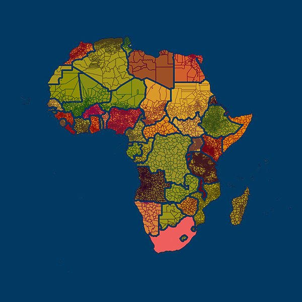
AfriGIS has Africa’s only verified and validated administrative boundary data

We are the first and only company that provides verified and validated geospatial data on Africa’s administrative boundaries, helping couriers, retailers, financial services and many more organisations do business across the continent.

Read More

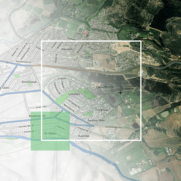
53rd Plenary Week ISO / TC211

AfriGIS, Africa's leaders in geospatial science and geospatial information solutions, will be attending the international ISO/TC211 Standards in Action workshop where countries showcase the work they are doing in the standards environment. This workshop is open to the public.

Read More

OGC 121st Members Meeting

AfriGIS, Africa's leaders in geospatial science and geospatial information solutions, will be attending the OGC 121st Members Meeting.

Read More

ISO/TC211 Standards in Action workshop

AfriGIS, Africa's leaders in geospatial science and geospatial information solutions, recently attended the international ISO/TC211 Standards in Action workshop where countries showcase the work they are doing in the standards environment. Various delegates from AfriGIS attended this inspiring workshop.

Read More

AfriGIS assists Financial Institutions to SAVE TIME

Submit a single or multiple coordinates in BULK and get immediate answers. AfriGIS assists Financial Institutions to SAVE TIME with AfriGIS Enterprise Reverse Geocoding for fixed and moveable assets.

Read More

A quick intro to geospatial standards and why they matter to you

There is a buzzword every year. We seem to have our pick of three letter acronyms and catch phrases in boardrooms in the same way we have top 20 music hits on the radio. “Geographical standards” have become one of those flavoured phrases.

Read More

The future of Big Data

The first quarter AfriGIS Data and Spatial Workshop took place on 3 April 2019 at the Bytes Technology Conference Centre in Gauteng, bringing together business and data experts to further explore the previous year’s theme on Big Data management, systems, procedures and analytics. This year, the focus in on the future of Big Data, and new ways of sustaining it...

Read More

Excellent customer service not an option, but a must-have!

Excellent customer service not an option, but a must-have! Mar 19 2018 SABS SANS 1883 and ISO compliant addresses AfriGIS address platform contains more than 40 Million searchable addresses Accurate and verified addresses...

Read More

How Location Insights answers the WHERE questions of your business

How Location Insights answers the WHERE questions of your business Dec 7 2017The fourth quarter AfriGIS Data and Spatial Workshop took place at the Bytes Conference Centre in Midrand on 6 December 2017. A lot of our longstanding and new clients from across Gauteng attended the event where changes and additions to the AfriGIS Dataset and Spatial Environment...

Read More

Standardisation a main driving force

Standardisation a main driving force Dec 6 2017 The 45th Plenary week of ISO/TC211 was held in Wellington, New Zealand, during the last week of November 2017. Like a symphony, it takes a lot of people working together to develop a standard. ISO’s role is similar to that of a conductor, while the orchestra is made up of independent technical experts nominated by our members...

Read More

High quality geographical data, trusted by government and corporate customers

High quality geographical data, trusted by government and corporate customers 13 Sep 2013 Technology innovation company, AfriGIS, held their 42nd successful Data Show at Bytes Conference Centre in Midrand on 5 September 2013. According to AfriGIS Managing Director, Magnus Rademeyer “constantly enhancing...

Read More

5 September 2013

AfriGIS Gauteng Data Show Bytes Conference Centre, Midrand

Read More

AfriGIS hosts 41st successful Data Show

AfriGIS hosts 41st successful Data Show 10 Jun 2013 Quality data resulting in innovative, world-class solutions Technology innovation company, AfriGIS, held their 41st successful Data Show at Bytes Conference Centre in Midrand on 6 June 2013. “Highlights of the latest data release include the improvement of the Deeds and Cadastre links, enhanced allocation...

Read More
We use cookies to give you the best experience.