Embracing the Power of Geospatial Technology:
(Pretoria, South Africa – 10 December 2023)

Discovering how the power of geospatial data is preparing industries to be future-ready
The final AfriGIS Data and Spatial Workshop for the year was held in Geographic Information Systems (GIS) month, on 22 November 2023 at the Premier Hotel in Midrand, Johannesburg. Themed “Embracing the Power of Geospatial Technology: Becoming Future-Ready,” the workshop explored the transformative impact of GIS across multiple sectors, and the crucial role of geospatial data in business decision-making.
First up was Christopher Ueckermann, Data Manager at AfriGIS, who presented the latest AfriGIS data release highlights and the 2023 updates. He delved into the importance of accurate, current information about our physical world, as it is essential for urban planning, environmental management, and disaster response.
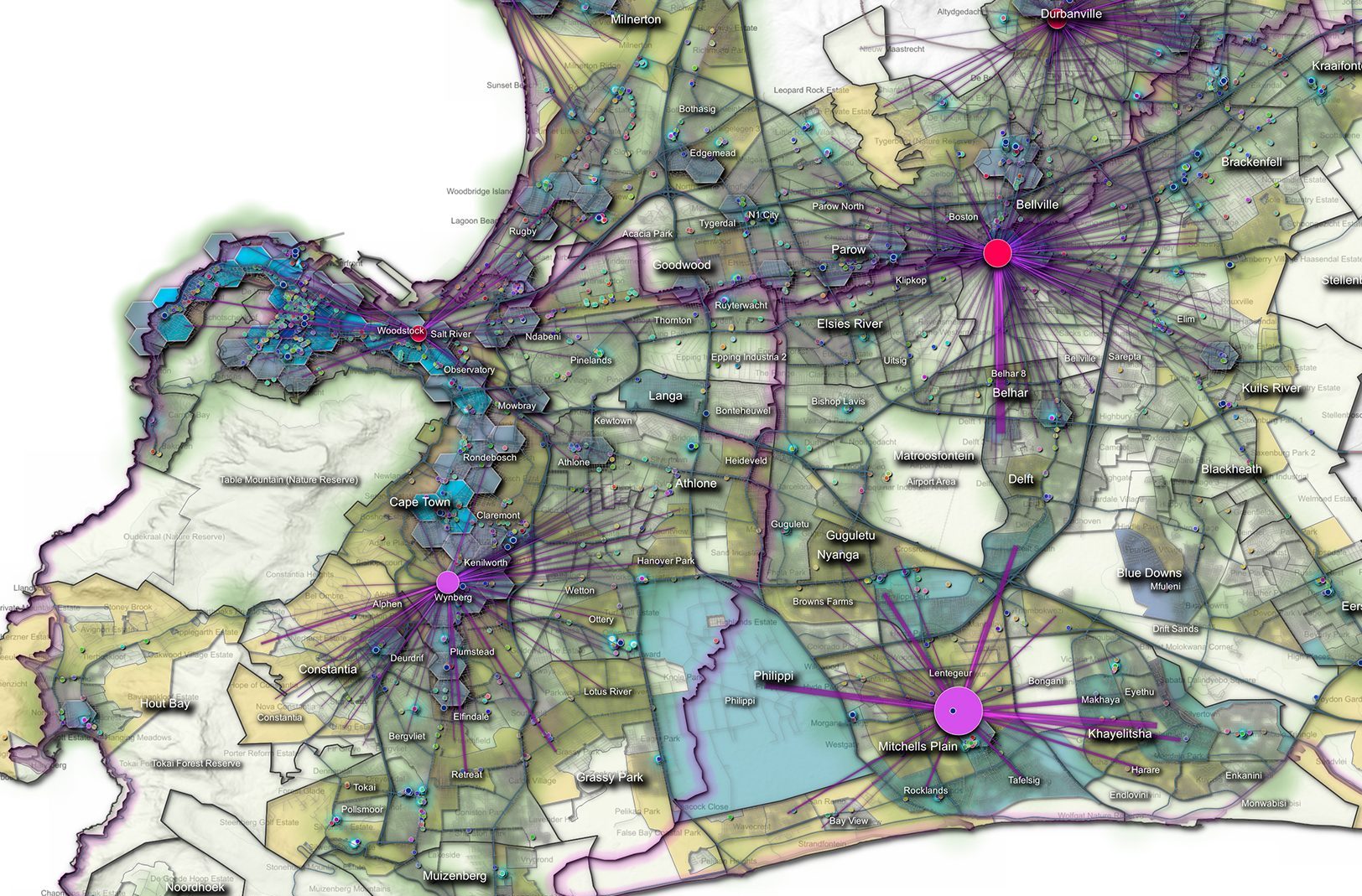
Access to the latest data helps in identifying changes in land use, monitoring environmental conditions, and planning infrastructure projects. Updated geospatial data supports the navigation and location-based services industry, critical for logistics and transport. In the context of climate change, timely updates of geospatial data enable better tracking of environmental changes, supporting sustainability and conservation efforts. In the era of big data and AI, updated geospatial datasets are invaluable for training and improving algorithms used in various applications. These factors demonstrate how geospatial data is pivotal in driving informed decision-making.
Ockie Arnoldi, Senior Client Consultant at AfriGIS, presented a case study on applying spatial strategies in the retail sector to make smarter business decisions. He demonstrated how AfriGIS helped a retail client to analyse data about where customers live, how they shop, and what they buy, based on their location. This information is being used to figure out the best places to open new stores, where to stock specific products, and how to plan efficient delivery routes. It also helps in targeting marketing efforts more effectively, understanding regional consumer preferences, and managing supply chains more efficiently – ultimately increasing sales and customer satisfaction by being in the right place with the right products.
Brian Civin, CSMO at AfriGIS and Marna Roos, Senior Client Consultant, presented an informative and entertaining session on planning for unpredictable events titled “Black Swan events and their spatial consequences.”
Black Swan events are inherently unpredictable and carry significant impact. Geospatial data is a vital component of modern risk management and resilience strategies as it instrumental in anticipating and mitigating the severe impacts of such rare events. For instance, by analysing historical and current geographical data, planners can identify patterns and vulnerabilities in specific areas, enhancing risk assessment and prediction capabilities. This allows for a more strategic allocation of resources and effective emergency planning.
By examining the geographical distribution and condition of vital systems like power grids, water supply networks, and communication channels, planners can identify potential weaknesses and devise strategies to strengthen these assets against unforeseen catastrophic events.
Real-time spatial data also becomes invaluable during an actual Black Swan event, enabling quick, informed decision-making that is essential for effective emergency response, managing evacuations, and ensuring the strategic deployment of resources. This data-driven approach ensures that societies are not only better prepared for the unexpected but also more adaptive and resilient in the face of the immense challenges posed by Black Swan events.
In closing, Civin said geospatial information systems (GIS) have become indispensable tools for organisations worldwide. “Accurate data is a fundamental pillar that influences every aspect of business operations. It serves as the foundation for informed decision-making, the development of future strategies, and overall success. At AfriGIS we recognise this, and we are committed to delivering the most precise and trustworthy geospatial data in the market.”
Civin encouraged collaboration and knowledge sharing among industry and GIS professionals, to contribute to the continued growth and development of GIS as a powerful tool for solving complex spatial problems.