

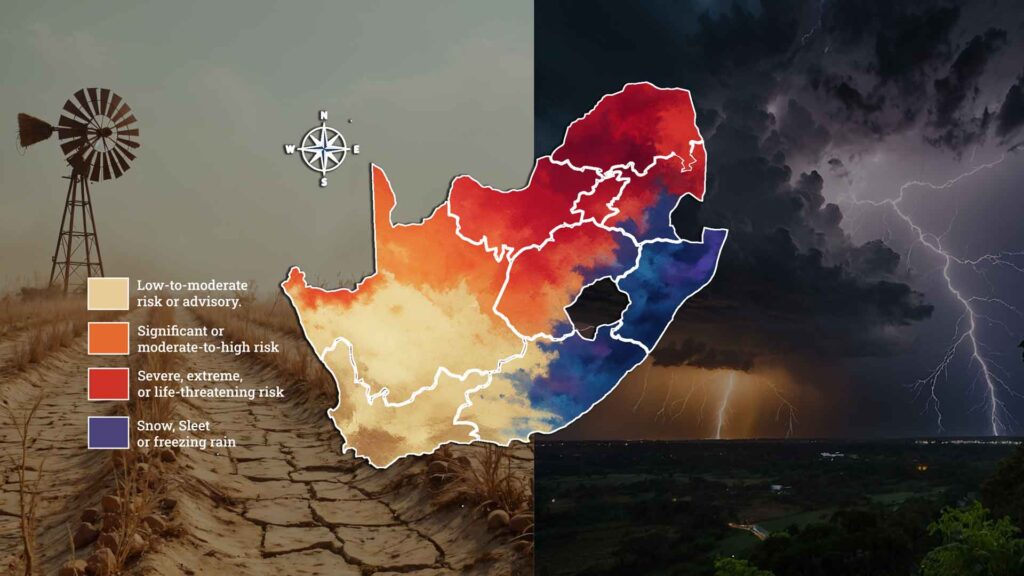
How AfriGIS Location Intelligence Maps South Africa's Super El Niño Risk
What rapid-response spatial intelligence knew before the Garden Route flooded again South Africa's Garden Route was hit by two cutoff low storms within a month, the second in early June 2026 bringing up to 200mm of rain across an already-satur…South Africa's Garden Route was hit by two cutoff low storms within a month, the second in early June 2026 bringing up to 200mm of rain across an already-saturated region with dams at full capacity, May's temporary road repairs still in place, and the N1 at Leeu Gamka eventually closing. Before that second storm peaked, AfriGIS had already used just four rapidly integrated spatial data layers roads, rivers, informal settlement locations, and storm warning data to identify 22 of the Garden Route's 209 informal settlements at extreme risk of losing all physical access, with Kannaland and George carrying 16 of those, enabling disaster management teams to pre-position resources and plan evacuation routes before conditions peaked. The deeper argument is that the same four-layer foundation becomes substantially more powerful with each additional dataset layered onto it: add deeds and cadastre data and an insurer can move to parcel-level flood underwriting; add CIPC business data and you can quantify revenue disruption, not just building damage; layer in infrastructure assets and Transnet, Sanral, and Eskom can each see where their balance-sheet exposure becomes critical. AfriGIS positions this building-block quality backed by 28 years of authoritative, never-crowdsourced verified data as the foundation for what national-scale spatial preparedness could deliver as SA's rainfall season runs through November.
Read More
She is signing herself in: What the deeds register tells us about women and property in South Africa
What rapid-response spatial intelligence knew before the Garden Route flooded again South Africa's Garden Route was hit by two cutoff low storms within a month, the second in early June 2026 bringing up to 200mm of rain across an already-satur…South Africa's Garden Route was hit by two cutoff low storms within a month, the second in early June 2026 bringing up to 200mm of rain across an already-saturated region with dams at full capacity, May's temporary road repairs still in place, and the N1 at Leeu Gamka eventually closing. Before that second storm peaked, AfriGIS had already used just four rapidly integrated spatial data layers roads, rivers, informal settlement locations, and storm warning data to identify 22 of the Garden Route's 209 informal settlements at extreme risk of losing all physical access, with Kannaland and George carrying 16 of those, enabling disaster management teams to pre-position resources and plan evacuation routes before conditions peaked. The deeper argument is that the same four-layer foundation becomes substantially more powerful with each additional dataset layered onto it: add deeds and cadastre data and an insurer can move to parcel-level flood underwriting; add CIPC business data and you can quantify revenue disruption, not just building damage; layer in infrastructure assets and Transnet, Sanral, and Eskom can each see where their balance-sheet exposure becomes critical. AfriGIS positions this building-block quality backed by 28 years of authoritative, never-crowdsourced verified data as the foundation for what national-scale spatial preparedness could deliver as SA's rainfall season runs through November.
Read More
SASDI's new standard turns a dot on a map into a fact you can build a billion rand budget on
What rapid-response spatial intelligence knew before the Garden Route flooded again South Africa's Garden Route was hit by two cutoff low storms within a month, the second in early June 2026 bringing up to 200mm of rain across an already-satur…South Africa's Garden Route was hit by two cutoff low storms within a month, the second in early June 2026 bringing up to 200mm of rain across an already-saturated region with dams at full capacity, May's temporary road repairs still in place, and the N1 at Leeu Gamka eventually closing. Before that second storm peaked, AfriGIS had already used just four rapidly integrated spatial data layers roads, rivers, informal settlement locations, and storm warning data to identify 22 of the Garden Route's 209 informal settlements at extreme risk of losing all physical access, with Kannaland and George carrying 16 of those, enabling disaster management teams to pre-position resources and plan evacuation routes before conditions peaked. The deeper argument is that the same four-layer foundation becomes substantially more powerful with each additional dataset layered onto it: add deeds and cadastre data and an insurer can move to parcel-level flood underwriting; add CIPC business data and you can quantify revenue disruption, not just building damage; layer in infrastructure assets and Transnet, Sanral, and Eskom can each see where their balance-sheet exposure becomes critical. AfriGIS positions this building-block quality backed by 28 years of authoritative, never-crowdsourced verified data as the foundation for what national-scale spatial preparedness could deliver as SA's rainfall season runs through November.
Read More
South Africa's new spatial data standards could be worth a percentage point of GDP
What rapid-response spatial intelligence knew before the Garden Route flooded again South Africa's Garden Route was hit by two cutoff low storms within a month, the second in early June 2026 bringing up to 200mm of rain across an already-satur…South Africa's Garden Route was hit by two cutoff low storms within a month, the second in early June 2026 bringing up to 200mm of rain across an already-saturated region with dams at full capacity, May's temporary road repairs still in place, and the N1 at Leeu Gamka eventually closing. Before that second storm peaked, AfriGIS had already used just four rapidly integrated spatial data layers roads, rivers, informal settlement locations, and storm warning data to identify 22 of the Garden Route's 209 informal settlements at extreme risk of losing all physical access, with Kannaland and George carrying 16 of those, enabling disaster management teams to pre-position resources and plan evacuation routes before conditions peaked. The deeper argument is that the same four-layer foundation becomes substantially more powerful with each additional dataset layered onto it: add deeds and cadastre data and an insurer can move to parcel-level flood underwriting; add CIPC business data and you can quantify revenue disruption, not just building damage; layer in infrastructure assets and Transnet, Sanral, and Eskom can each see where their balance-sheet exposure becomes critical. AfriGIS positions this building-block quality backed by 28 years of authoritative, never-crowdsourced verified data as the foundation for what national-scale spatial preparedness could deliver as SA's rainfall season runs through November.
Read More
The data problem beneath South Africa's stalled renewal projects
What rapid-response spatial intelligence knew before the Garden Route flooded again South Africa's Garden Route was hit by two cutoff low storms within a month, the second in early June 2026 bringing up to 200mm of rain across an already-satur…South Africa's Garden Route was hit by two cutoff low storms within a month, the second in early June 2026 bringing up to 200mm of rain across an already-saturated region with dams at full capacity, May's temporary road repairs still in place, and the N1 at Leeu Gamka eventually closing. Before that second storm peaked, AfriGIS had already used just four rapidly integrated spatial data layers roads, rivers, informal settlement locations, and storm warning data to identify 22 of the Garden Route's 209 informal settlements at extreme risk of losing all physical access, with Kannaland and George carrying 16 of those, enabling disaster management teams to pre-position resources and plan evacuation routes before conditions peaked. The deeper argument is that the same four-layer foundation becomes substantially more powerful with each additional dataset layered onto it: add deeds and cadastre data and an insurer can move to parcel-level flood underwriting; add CIPC business data and you can quantify revenue disruption, not just building damage; layer in infrastructure assets and Transnet, Sanral, and Eskom can each see where their balance-sheet exposure becomes critical. AfriGIS positions this building-block quality backed by 28 years of authoritative, never-crowdsourced verified data as the foundation for what national-scale spatial preparedness could deliver as SA's rainfall season runs through November.
Read More
Before the brick, and before the storm
What rapid-response spatial intelligence knew before the Garden Route flooded again South Africa's Garden Route was hit by two cutoff low storms within a month, the second in early June 2026 bringing up to 200mm of rain across an already-satur…South Africa's Garden Route was hit by two cutoff low storms within a month, the second in early June 2026 bringing up to 200mm of rain across an already-saturated region with dams at full capacity, May's temporary road repairs still in place, and the N1 at Leeu Gamka eventually closing. Before that second storm peaked, AfriGIS had already used just four rapidly integrated spatial data layers roads, rivers, informal settlement locations, and storm warning data to identify 22 of the Garden Route's 209 informal settlements at extreme risk of losing all physical access, with Kannaland and George carrying 16 of those, enabling disaster management teams to pre-position resources and plan evacuation routes before conditions peaked. The deeper argument is that the same four-layer foundation becomes substantially more powerful with each additional dataset layered onto it: add deeds and cadastre data and an insurer can move to parcel-level flood underwriting; add CIPC business data and you can quantify revenue disruption, not just building damage; layer in infrastructure assets and Transnet, Sanral, and Eskom can each see where their balance-sheet exposure becomes critical. AfriGIS positions this building-block quality backed by 28 years of authoritative, never-crowdsourced verified data as the foundation for what national-scale spatial preparedness could deliver as SA's rainfall season runs through November.
Read More
What the Garden Route floods proved about spatial preparedness
What rapid-response spatial intelligence knew before the Garden Route flooded again South Africa's Garden Route was hit by two cutoff low storms within a month, the second in early June 2026 bringing up to 200mm of rain across an already-satur…South Africa's Garden Route was hit by two cutoff low storms within a month, the second in early June 2026 bringing up to 200mm of rain across an already-saturated region with dams at full capacity, May's temporary road repairs still in place, and the N1 at Leeu Gamka eventually closing. Before that second storm peaked, AfriGIS had already used just four rapidly integrated spatial data layers roads, rivers, informal settlement locations, and storm warning data to identify 22 of the Garden Route's 209 informal settlements at extreme risk of losing all physical access, with Kannaland and George carrying 16 of those, enabling disaster management teams to pre-position resources and plan evacuation routes before conditions peaked. The deeper argument is that the same four-layer foundation becomes substantially more powerful with each additional dataset layered onto it: add deeds and cadastre data and an insurer can move to parcel-level flood underwriting; add CIPC business data and you can quantify revenue disruption, not just building damage; layer in infrastructure assets and Transnet, Sanral, and Eskom can each see where their balance-sheet exposure becomes critical. AfriGIS positions this building-block quality backed by 28 years of authoritative, never-crowdsourced verified data as the foundation for what national-scale spatial preparedness could deliver as SA's rainfall season runs through November.
Read MoreWhat rapid-response spatial intelligence knew before the Garden Route flooded again
What rapid-response spatial intelligence knew before the Garden Route flooded again South Africa's Garden Route was hit by two cutoff low storms within a month, the second in early June 2026 bringing up to 200mm of rain across an already-satur…South Africa's Garden Route was hit by two cutoff low storms within a month, the second in early June 2026 bringing up to 200mm of rain across an already-saturated region with dams at full capacity, May's temporary road repairs still in place, and the N1 at Leeu Gamka eventually closing. Before that second storm peaked, AfriGIS had already used just four rapidly integrated spatial data layers roads, rivers, informal settlement locations, and storm warning data to identify 22 of the Garden Route's 209 informal settlements at extreme risk of losing all physical access, with Kannaland and George carrying 16 of those, enabling disaster management teams to pre-position resources and plan evacuation routes before conditions peaked. The deeper argument is that the same four-layer foundation becomes substantially more powerful with each additional dataset layered onto it: add deeds and cadastre data and an insurer can move to parcel-level flood underwriting; add CIPC business data and you can quantify revenue disruption, not just building damage; layer in infrastructure assets and Transnet, Sanral, and Eskom can each see where their balance-sheet exposure becomes critical. AfriGIS positions this building-block quality backed by 28 years of authoritative, never-crowdsourced verified data as the foundation for what national-scale spatial preparedness could deliver as SA's rainfall season runs through November.
Read More
Why static property data is costing South African short-term insurers their margins
Why static property data is costing South African short-term insurers their margins South Africa's short-term insurers are pricing property risk against municipal valuation rolls built for tax collection, updated on multi-year cycles, and reflecting a version of the country that no longer exists in many areas. As semigration accelerates to secondary hubs and infrastructure struggles to keep pace, a blocked stormwater drain or outdated flood wall can transform a historically low-risk property into an active hazard overnight. Insurers relying on lagging municipal records will miss these shifts entirely, and the exposure only becomes visible after a severe weather event. The solution is exact geocoding. By pinning property records to precise geographic coordinates, underwriters can overlay real-time spatial layers covering flood lines, fire hazards, weather patterns, and infrastructure constraints, enabling street-by-street risk pricing rather than broad municipal approximations. The same intelligence extends to operations: geofenced hail alerts warn policyholders before damage occurs, and satellite imagery cross-referenced with deeds data automates agricultural claims validation. Insurers who embed location intelligence into their workflows move from reactive loss management to proactive, precision underwriting.
Read More
Combatting synthetic identity fraud with physical location intelligence in KYC
Combatting synthetic identity fraud with physical location intelligence in KYC Financial criminals are skilled at fabricating convincing paper and digital trails, but what they cannot replicate is physical reality. Every legitimate consumer and business leaves a spatial fingerprint over time, and building years of realistic spatial behaviour for a fake identity is cost-prohibitive. By cross-referencing deeds registry data, which AfriGIS updates monthly, with CIPC company registration records updated weekly, lenders can automatically surface red flags before any transaction occurs. A registered headquarters mapping to a vacant field, or a business activity conflicting with a property's zoning, becomes visible through automated reconciliation of physical reality against administrative records. It is cheap to create a digital record, but expensive to put a physical building on a piece of land. Generative AI has made synthetic personas easier to construct than ever, but spatial reality remains difficult to fake. By anchoring digital identities to verified physical addresses, organisations establish an objective layer of truth that shifts fraud prevention from reactive investigation to proactive, real-time defence.
Read More