

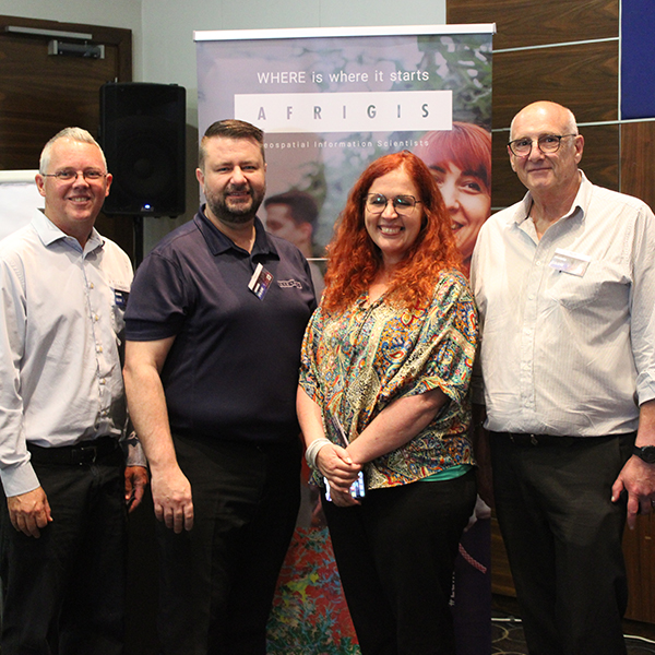
Embracing the Power of Geospatial Technology.
The AfriGIS Data and Spatial Workshop, held on November 22, 2023, at the Premier Hotel in Midrand, Johannesburg, marked a significant event in the GIS community. Themed “Embracing the Power of Geospatial Technology: Becoming Future-Ready,” the workshop brought together experts and enthusiasts in the field of Geographic Information Systems (GIS) to explore the ever-evolving landscape of geospatial technology and its transformative impact across multiple industries.
Read More
Embrace AI but be aware of the data pitfalls for the unwary
While AI has made remarkable progress in recent years and offers numerous benefits across industries, it is essential to be aware of the potential risks associated with its adoption. Unvalidated data sources, manipulated data, copyright infringement, loss of data control, and undifferentiated business outcomes are among the challenges to consider.
Read More
Thank you – yes, you!
Why are maps more potent today than ever and very different from the ones we first encountered stored in rolls for Geography lessons at school? Brian Civin has been around considerably longer than AfriGIS’ 25 years (this May). And he has a key insight into why maps are a (not-so-secret) powerful new business enabler.
Read More
AfriGIS turns 25
This May we turn 25 years old, at a time when the industry's fortunes look set to soar.
Read More
8 ways we make location intelligence better
Why should you care what geospatial information and geographic information systems are?
Read More
How you can access fast financial services growth too
We don’t always need more data. Sometimes we need better data that’s more relevant so we can find new opportunities, new ways to serve customers, new ways to help the burgeoning teams of data scientists, product managers, marketers, and all the other people dedicated to turning things around and staying the path.
Read More
Locating the Future with the Power and Potential of GIS
It is our belief that the power of GIS lies in its ability to transform organisational outcomes. That location-based intelligence solutions enhances customer satisfaction, grows revenue streams, streamlines operational performance, and ensures sustained profitability – regardless of the business sector.
Read More
University of Pretoria: Faculty of Natural and Agricultural Science Department of Geography, Geoinformatics and Meteorology Advisory Committee meeting
The Advisory Committee aims to liaise in a formal and structured way and on a regular basis with all sectors of the industry. This assists the department to develop and maintain a programme that meets the requirements of the industry and the workplace.
Read More
South Africa’s new smart cities: a roadmap for transforming all our cities
We are on the edge of a geospatial transformation in South Africa. GIS is the ultimate ‘connector of dots’, and is the key to unlocking the true value and potential of the smart technology that’s required to digitise urban ecosystems and make smarter cities a reality. GIS has the power to unlock rich new insights, power better decision-making, and act as a catalyst for new products and services across all industry sectors. It has the potential to add billions to our economy, improve the quality of life and wellbeing of our communities, and help protect our planet.
Read More
Meet AfriGIS Iris: A Window into the Inner World of Our Solutions
AfriGIS Iris was developed by our team of geospatial scientists with the explicit aim of taking you on an interactive journey to demonstrate the capabilities of AfriGIS Solutions.
Read More